Khartoum: Amarat Street 15, improved for everyday life.
Improve walking, crossings, parking and drainage on the existing Amarat Street 15 corridor; keep its shops and street character.
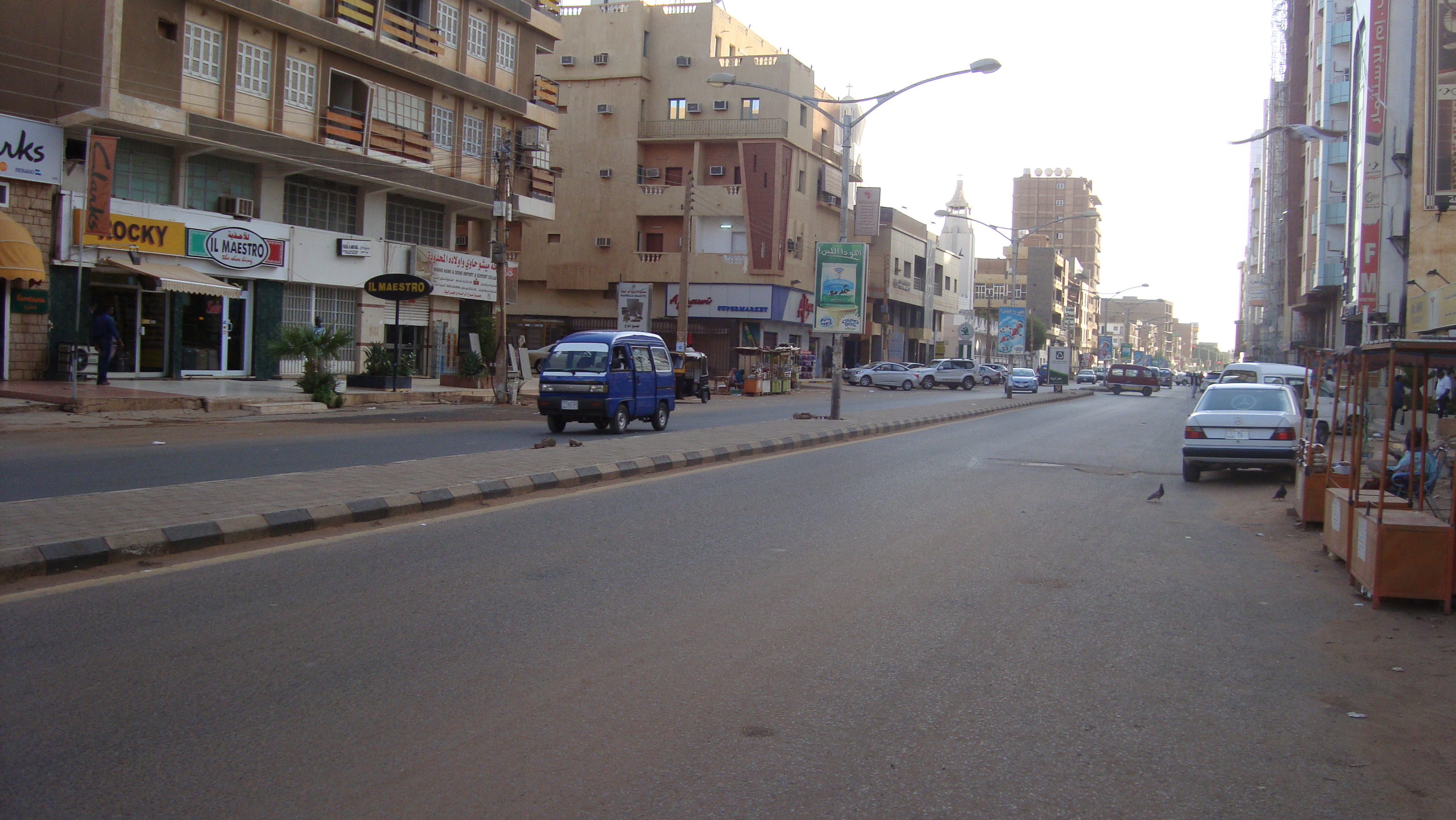
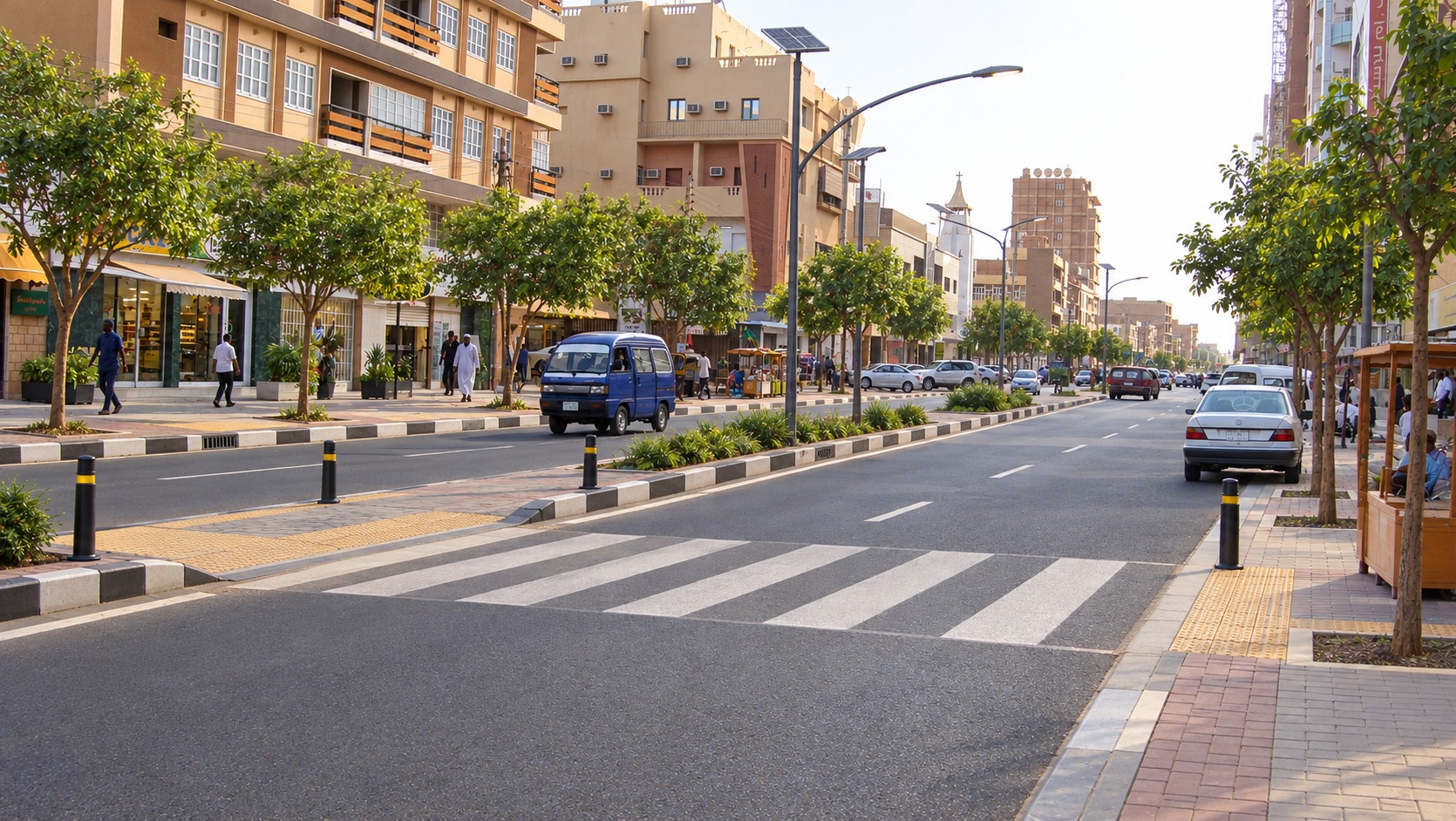 REAL ARCHIVAL PHOTO · JUN 2012AI future concept
Original: Amarat Street (15), Khartoum · 16 June 2012 · عاصم الرشيد التوم.
Photograph source Original photograph and AI adaptation: CC BY-SA 3.0Capture dates describe the photographed moment, not current conditions. The future image is an AI adaptation, not an approved design, completed work or endorsement by the photographer or owner.
This is a community planning brief. The photographed site is not enrolled or approved for work. Current surveys, lawful consent, local partners, costs and funding still need to be agreed.
How do we make this happen?
Start with this community
Walk the street with residents, shop staff, bus and minibus users, delivery drivers and disabled pedestrians. Map actual crossing points and identify parking changes the community can accept.
Street users decide the pilot crossing and delivery priorities; the design must preserve access to existing businesses.
A manageable first phase
One agreed junction-to-junction section, sized by a current survey; not a new road or a replacement skyline.
The place and its connections
Not surveyed or to scale. A qualified local team must design the actual work.
People we need
- Residents, shopkeepers and public-transport users to set access priorities.
- Traffic, accessibility and drainage designers plus a municipal liaison.
- Paving crews, lighting electricians and a local maintenance lead.
Equipment we need
- Survey and utility-location equipment before any excavation.
- Small excavation and compaction equipment appropriate to a live commercial street.
- Traffic-management barriers and lighting test equipment.
Materials to source
- Durable pavement surfaces, kerb ramps, crossing markings and drainage components.
- Suitable shade trees, tree guards and tested streetlighting where justified.
The delivery sequence
- 01
Document walking routes, crossing demand, parking and deliveries.
- 02
Survey levels and utilities and agree the drainage outlet.
- 03
Test the proposed crossing and access changes with street users.
- 04
Deliver drainage, accessible paving and crossings in short sections.
- 05
Check accessibility and drainage with residents, then publish the maintenance schedule.
What needs pricing
- Traffic and drainage surveyLocal quote required
- Kerbs, crossings and continuous pavementLocal quote required
- Parking and delivery arrangements during worksLocal quote required
- Trees, lighting, inspection and upkeepLocal quote required
No verified budget or construction date yet. Quotes must include local labour, transport, contingency and continuing maintenance.
How we measure success
- Continuous step-free pavement and agreed crossing points.
- Drainage checked after rain and defects logged by street users.
Evidence to publish
Publish local consent, the current assessment, itemised quotes, inspection results, redacted invoices and the handover plan for this project.
Your knowledge belongs in the plan.
Suggest an improvement, share a drawing or document, offer local knowledge or identify a practical missing piece. Proposals are reviewed before becoming public; they do not directly overwrite the project plan.
Join the project conversation
Sign in or create an account to submit proposals and track review. You can read the full project without an account.
Community proposals & discussion
No reviewed contributions yet. Be the first to improve this project.
Submit → moderation → technical and community review → a documented design revision. Publication means the contribution passed moderation, not that it is an approved engineering design.
Track your submissions ↗